You're Not Crazy — The 2017 Hurricane Season Has Been Particularly Bad, And Here's Why
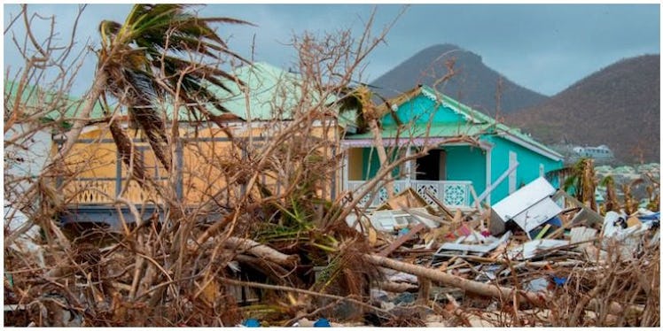
Harvey flooded Houston. Irma, the strongest Atlantic hurricane in recorded history, ravaged the Caribbean and Florida. Jose is creeping up on New England. And now Maria has left a path of destruction in the Caribbean, even wiping out power to the entire island of Puerto Rico. You're not imagining it -- this hurricane season is punishing. But why is the 2017 hurricane season so bad? USA Today says it's the worst year by "various meteorological standards" and for myriad reasons.
Seriously, you're not hallucinating. Hurricane season runs from June 1 to Nov. 30, according to Live Science, though the season peaks from August to October. And National Geographic reports that, while the National Oceanic and Atmospheric Administration (NOAA) predicted an above-average season for 2017, NOAA predicted 14 to 19 named storms and only five to nine hurricanes. And, with two months to go, we've already had four hurricanes -- one of which was the strongest Atlantic hurricane in recorded history. This year handily meets the NOAA definition of an "extremely active" hurricane season.
To put into perspective: There have been 13 named storms this year. The New York Times reports that "only four other seasons since 1995 have had that many by Sept. 18. Just two more by the end of the year would put 2017 in the top 15 since 1851, when reliable records began."
OK, but why? Are we being cosmically punished?
While I can't address fears of cosmic punishment, I can at least point out some more easily measured metrics. (Though, on the note of cosmic punishment, one man believes the beginning of the end of the world will come on Sept. 23, so do with that information what you will.)
But nope. It's about weather patterns and atmospheric conditions.
NatGeo sums it up thusly: "[A]tmospheric conditions were hurricane-friendly, and surface sea temperatures were warmer than usual." But what does that actually mean? Well, hurricanes need warm air, consistent wind speeds on the surface and 10 miles up, and warm water temperatures in order to form and remain stable. These storms have found that in spades this year. Another part of the problem is, weirdly, likely the "lack of dust blowing across the Atlantic from Africa, which tends to having a drying effect on developing storms," according to USA Today.
Another factor is the fact that El Niño is late to the party this year. Essentially, El Niño is part of a normal weather pattern in which Pacific water temperatures rise slightly. This also usually creates wind patterns which can prevent the formation or strengthening of tropical storms.
In late July, long before Harvey and Irma and Maria, AccuWeather predicted that a delay in El Niño might increase the number of tropical storms and hurricanes, in part because El Niño wouldn't be around to cut through the winds which often help strengthen tropical storms. Rude.
Because we still have over two months left in hurricane season, that means we could very well be looking at more storms -- including more hurricanes.
But why is El Niño late, and why is the Atlantic warmer than usual, and why are these storms able to gain strength as they make landfall?
Yep — it's our old friend, climate change.
Hurricanes tend to weaken as they reach land due to lost access to warm water and air (the two things that fuel hurricanes), but that might be changing due to climate change. Ocean temperatures have risen dramatically, which means that hurricanes have more to work with. (This is one of the reasons that Harvey was so strong.)
The NOAA reports that warming of the ocean has doubled in recent decades. Data from both the Environmental Protection Agency and NASA show that the ocean has warmed about 1.4 degrees Fahrenheit. While that may not sound like a lot, don't forget that's an average. NASA explains, "In the past, a one- to two-degree drop was all it took to plunge the Earth into the Little Ice Age. A five-degree drop was enough to bury a large part of North America under a towering mass of ice 20,000 years ago."
And while the nature of hurricanes makes it hard to pin down trends, NatGeo says that "predictions based on warming suggest that average-intensity tropical cyclones -- Atlantic hurricanes included -- will likely get more intense."
Thanks to climate change, we could be looking at more frequent, more intense storms and storms more likely to make landfall.
Maybe that doomsday prediction isn't too far off.
Check out the entire Gen Why series and other videos on Facebook and the Bustle app across Apple TV, Roku, and Amazon Fire TV.